

It has been 3 years since the National Weather Service Storm Prediction Center alerted us to a level 3 out of 5 severe weather risk this far in advance. This is also the first time we are seeing a 10% risk for tornadoes since the beginning of the Storm Prediction Center outlooks in 2020.
Damaging wind gusts and even tornadoes are possible from noon Sunday into the early evening as a storm approaches from the west.
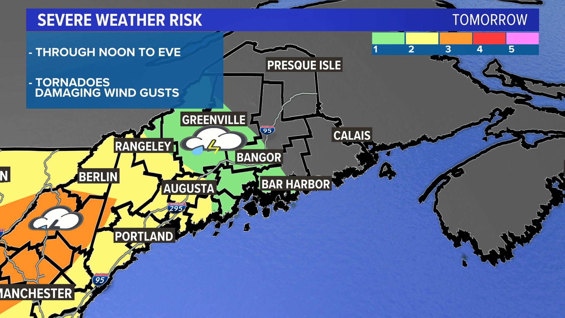
The threat starts at a level 1 (lowest out of 5) from Greenville, Bangor and Bar Harbor southwest to outside Augusta, as the storms will lose momentum by the time they reach Down East and northern Maine.
We get up to a level 2 out of 5 from Rangeley, Augusta and down to the Rockland area pushing southwest to Oxford and York counties. This is where the severe thunderstorm threat covers the most areas, with favorable conditions expected thanks to sunshine at midday.
The severe threat is highest over southwestern Oxford County into Carroll and Coos counties in New Hampshire. In central New Hampshire, conditions are most favorable for tornadoes and damaging wind gusts during the midday hours.
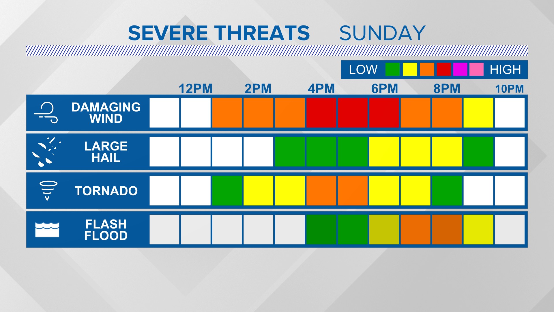
Here’s a timeline of the threats and when you can expect them. This mostly applies to the yellow and orange shaded areas. The thunderstorms will slide east later Sunday afternoon and evening.
Flooding on a localized scale could become an issue as the storms turn into broken segments and go over the same towns in the evening. Watch for standing water, and be aware of down lines and branches.
This is an idea of what the radar will look like Sunday afternoon. The clusters of thunderstorms and broken line segments will be moving east.
If a tornado or severe thunderstorm watch is issued, here’s what you need to know.
Comments are not available on this story.
Send questions/comments to the editors.
